Overview
Features
Workflow
Security
Pricing
Videos
Contact Us
Login ->
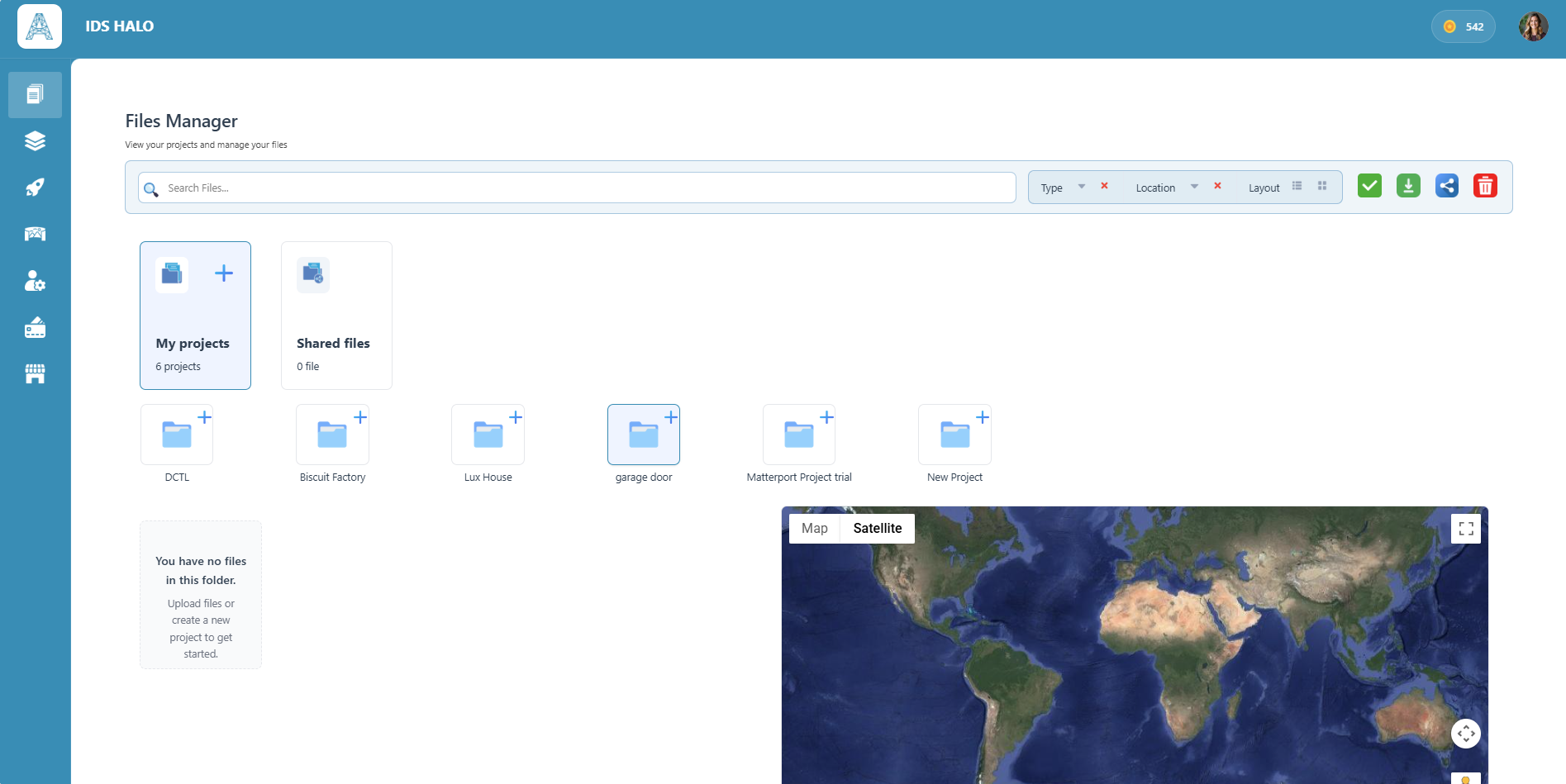
Cloud collaboration for Reality Capture data
Same scans. More control. Less friction.
Geo-Spatial
Reference
Actively Monitor
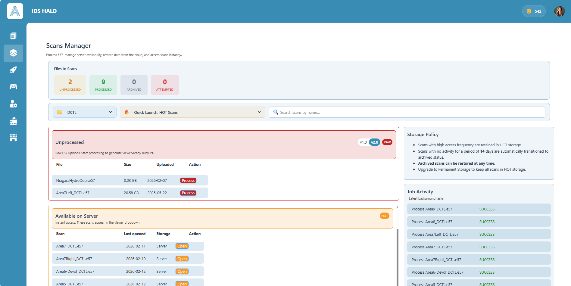
Hot and Cold Scans
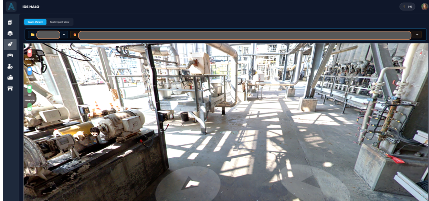
Visualize the Real Site or
the Scans Collaboratively
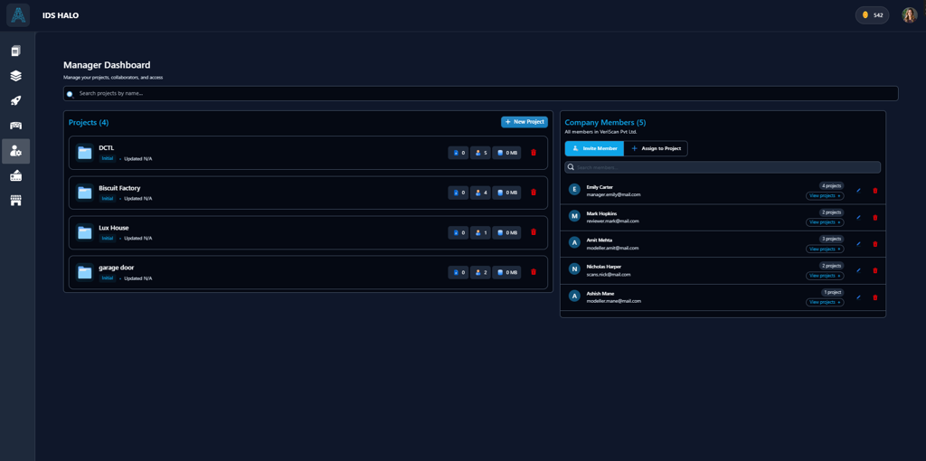
Unified Team Collaboration with
Live Discussion and Monitoring
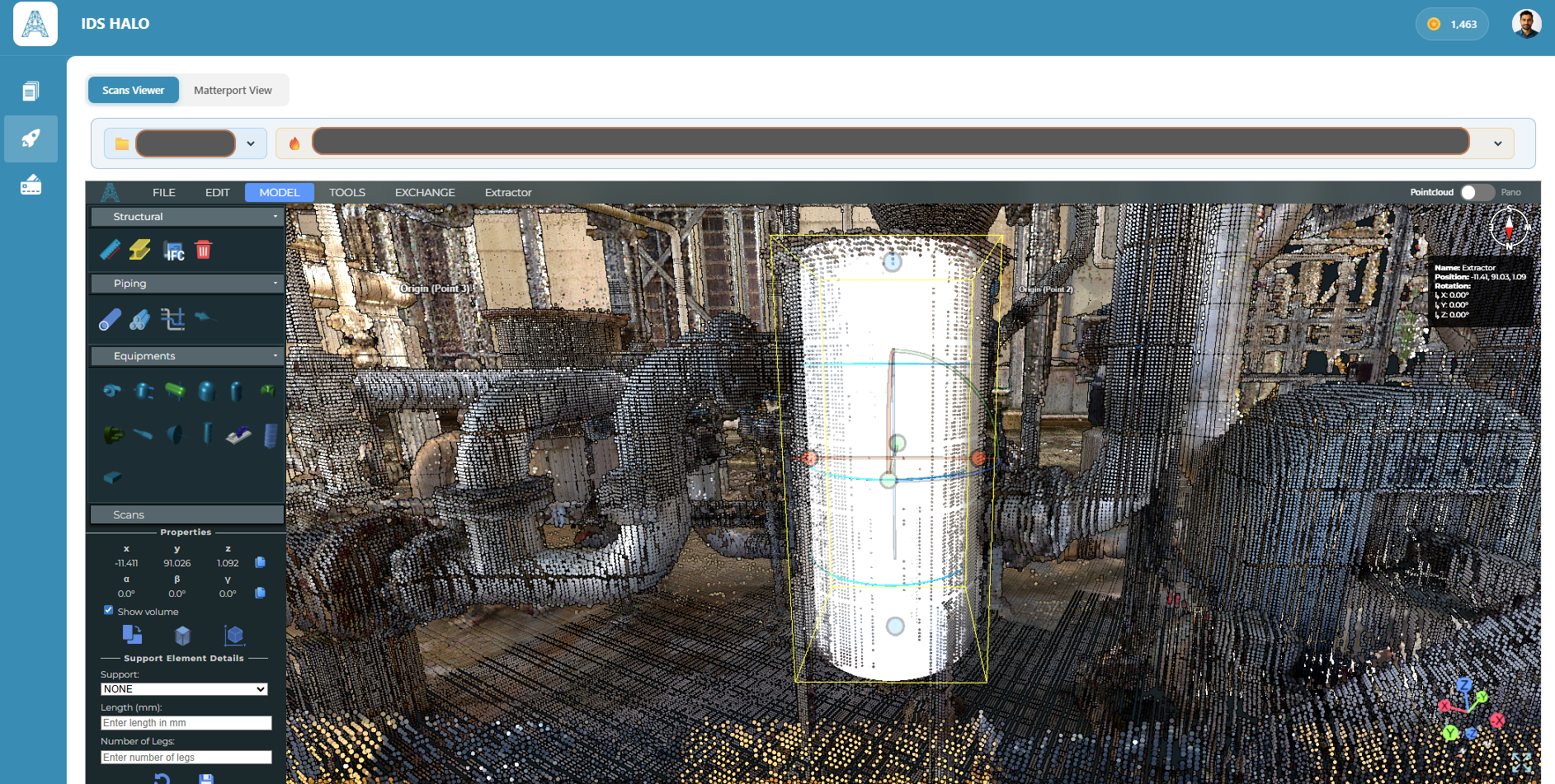
Generate CAD Models with
Precision and Speed
Model Review Tools
for Design Verification
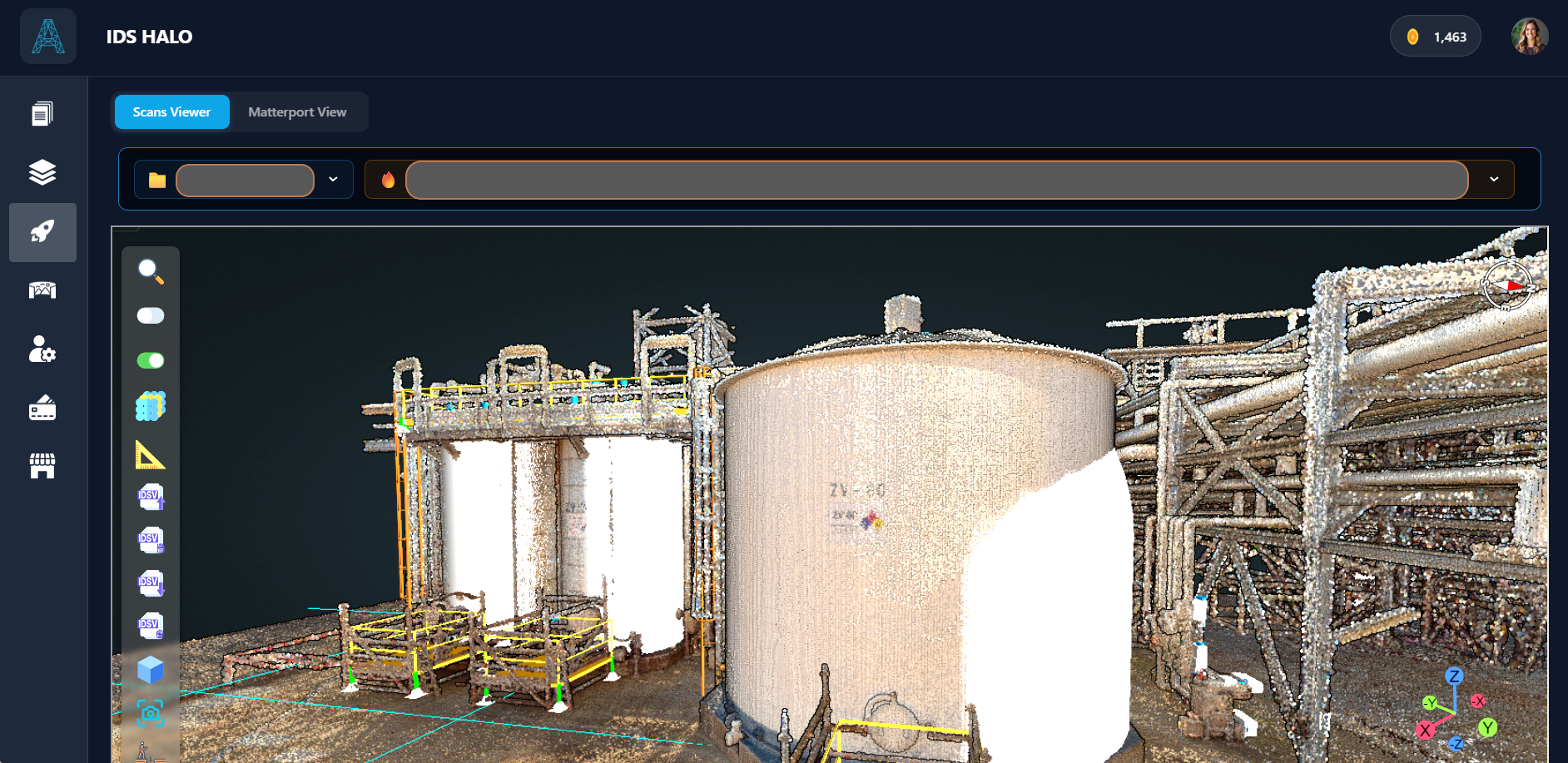
Superimpose CAD on Scans
See exactly what matches and what doesn't
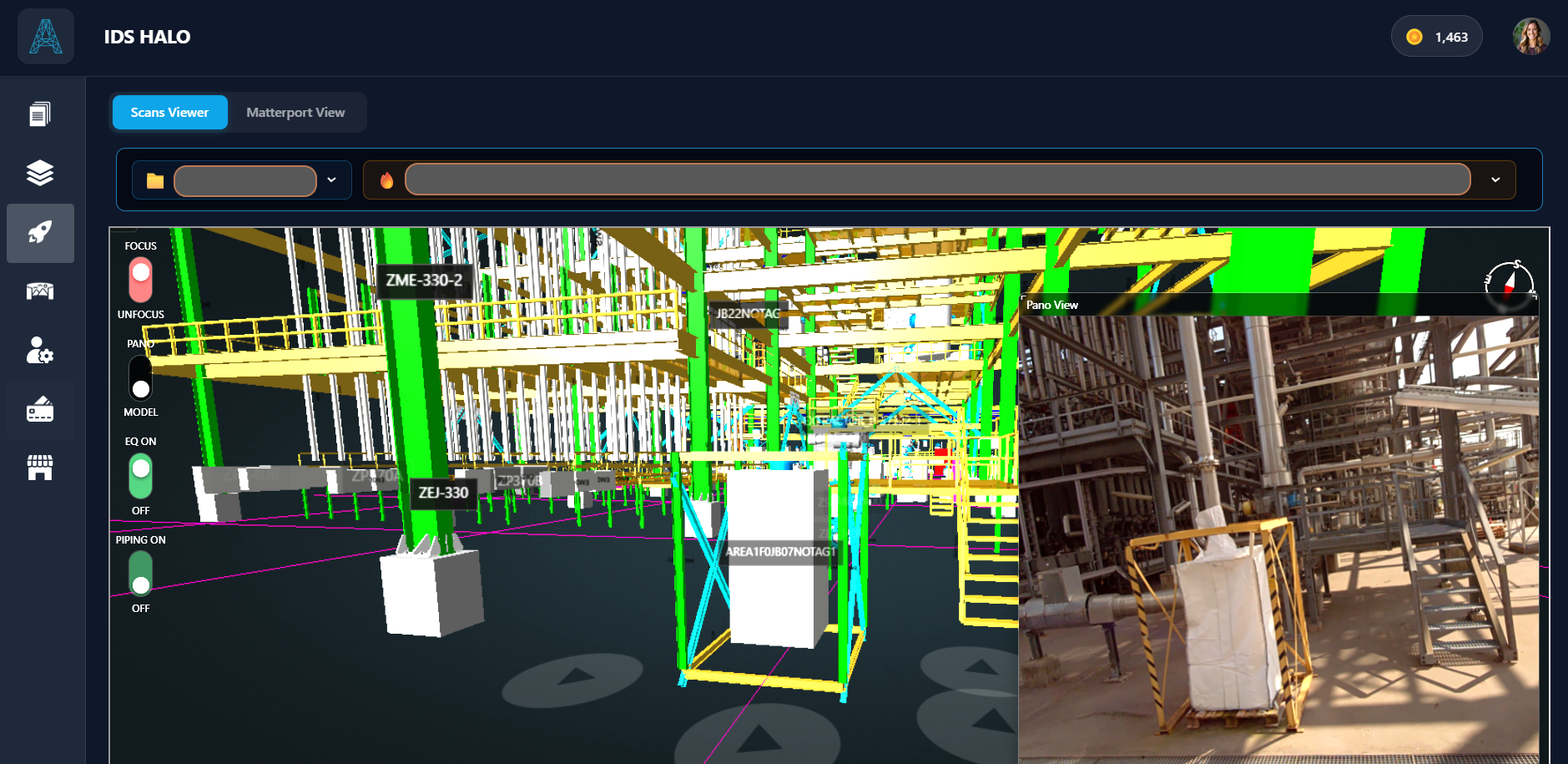
Split-screen view
Side-by-Side CAD and panoramic image for verification
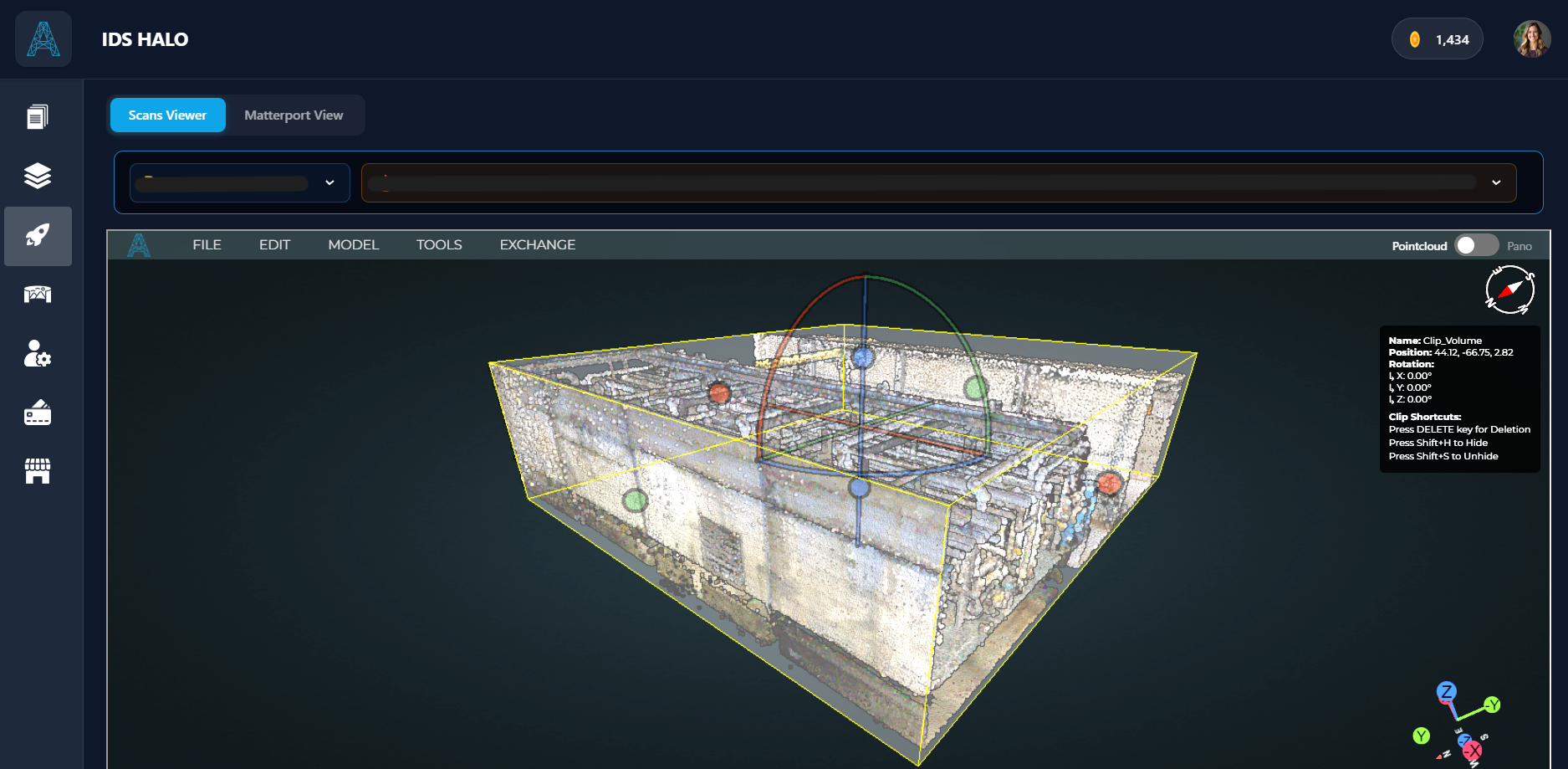
Clipping Tool
Isolate Areas of Interest Within Scans for Focused Evaluation
© Copyright 2026
ASETS-CA Inc
.png) Login ->
Login ->